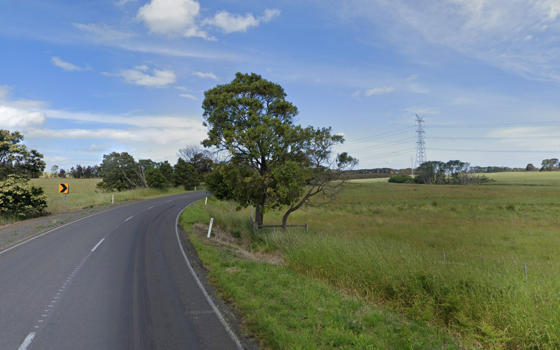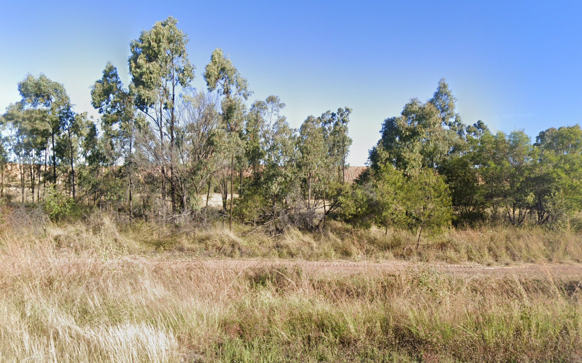
Coal pit · 180 m from the highway
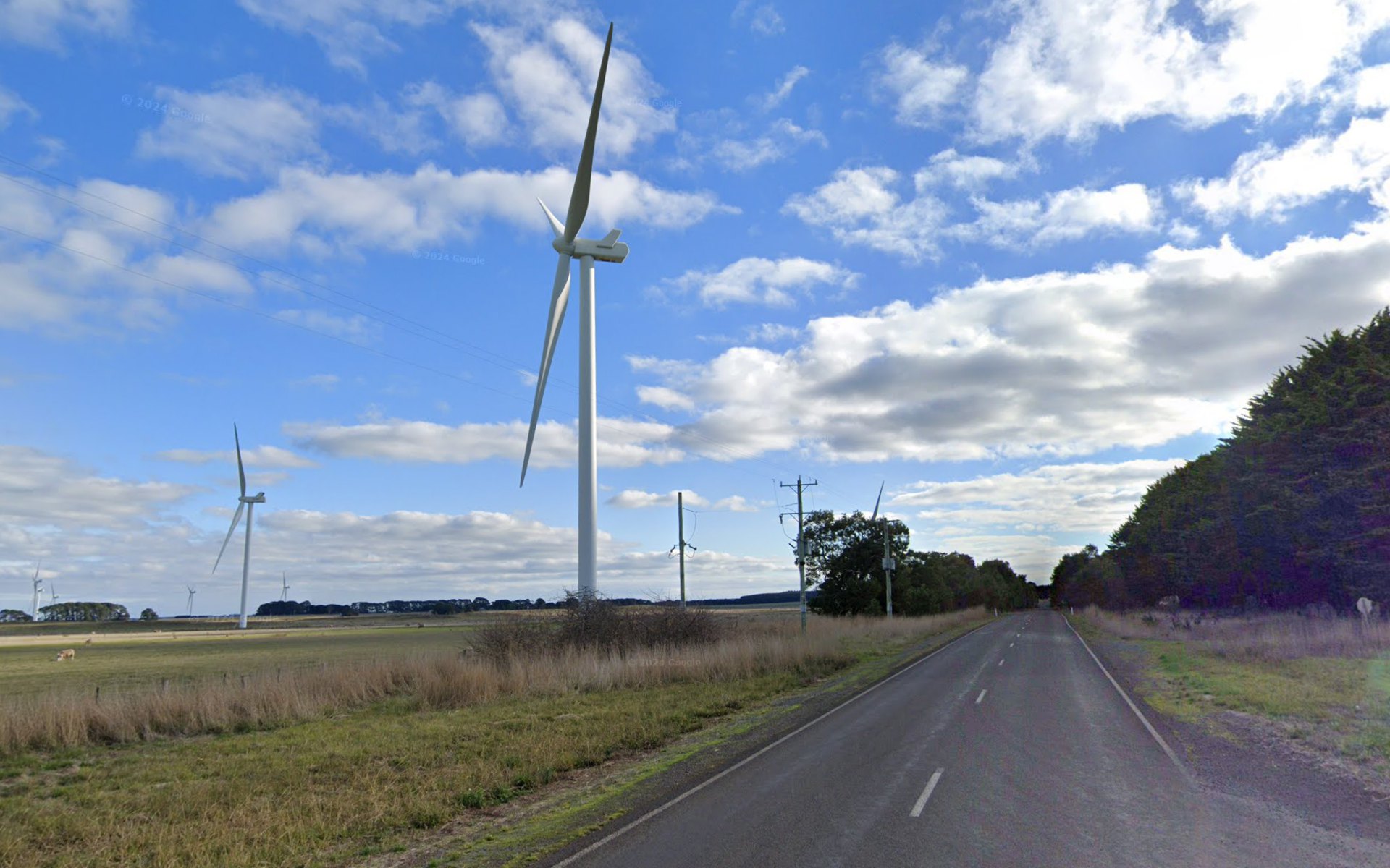
Turbine · 185 m from the road
A ground-level test
You need an aeroplane to see the coal mine.
Same sort of camera. Public roads. About 180 metres.
Scroll
The joke
A satirical post puts an aerial photograph next to a thing you meet on the ground.
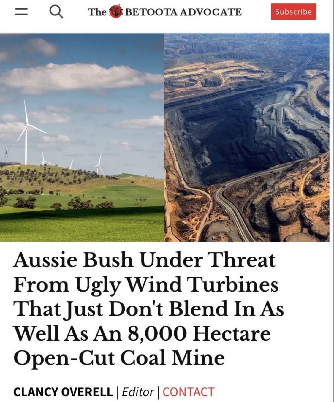
On 31 October 2026 I replied to this satirical post. The headline, bylined to Clancy Overell, was:
Aussie Bush Under Threat From Ugly Wind Turbines That Just Don't Blend In As Well As An 8,000 Hectare Open-Cut Coal Mine.
One half is turbines in a green paddock, photographed from the ground. The other half is an open cut, photographed from the air. The joke treats those as the same kind of view.
A coal pit is a hole. Until you are above it, or standing on a purpose-built lookout, the void sits below the ground you are on. A turbine is a tower, usually on a ridge. This page tests that the way a driver would meet it: Street View, from the nearest public road, aimed at the thing.
My reply is here. The Betoota Advocate’s own post that day is text and a link, with no picture attached: that post. The “8,000 hectare” mine is a joke, and it is the right order of magnitude for a big Hunter pit’s disturbed ground. It is not a surveyed area, and it is not the Bluff mine in the replies.
The same jab
The mine fills the frame. The turbines are a circle on the horizon.
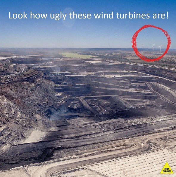
The joke is the same one. An open cut, shot from the air, set against turbines you could see from the ground. The pit is the picture. The towers are the punchline in the corner.
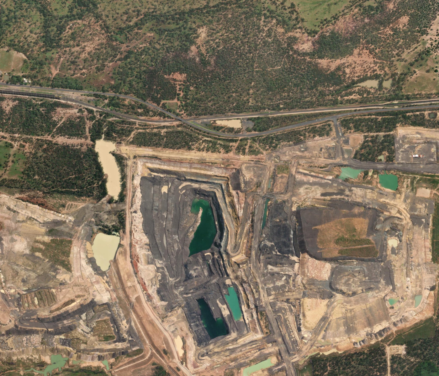
Bluff, Queensland · from above
From the air, it is a wound.
This is the mine in the thread. It sits on Trish Goodwin’s cattle farm, 175 km west of Rockhampton, beside the Capricorn Highway. The Guardian, on 20 September 2026, called it “cut like a gaping wound into her cattle farm.” Lock the Gate’s Claire Gronow, in the same piece: “a dirty big hole in the ground that’s just going to keep polluting forever – or until someone cleans it up.”
The mining lease is about 1,100 hectares. The open cut mapped on OpenStreetMap, and visible here, is about 180 hectares. Terraces, coal, green water, and the highway along the top of the frame.
Capricorn Highway · about 180 m to the mapped rim
From the highway, the hole is below you.
June 2025. The closest Street View point to the northern rim, looking south. The camera is about 180 metres from the mapped edge of the open cut. The middle of that mapped pit is about 1.5 km further on. Between the road and the void: grass, a track, and a line of trees. A pale batter shows through the canopy. The terraces and the green water stay out of the frame.
This is the same test as Adam Waite’s, from closer in. The scar is a view from above.
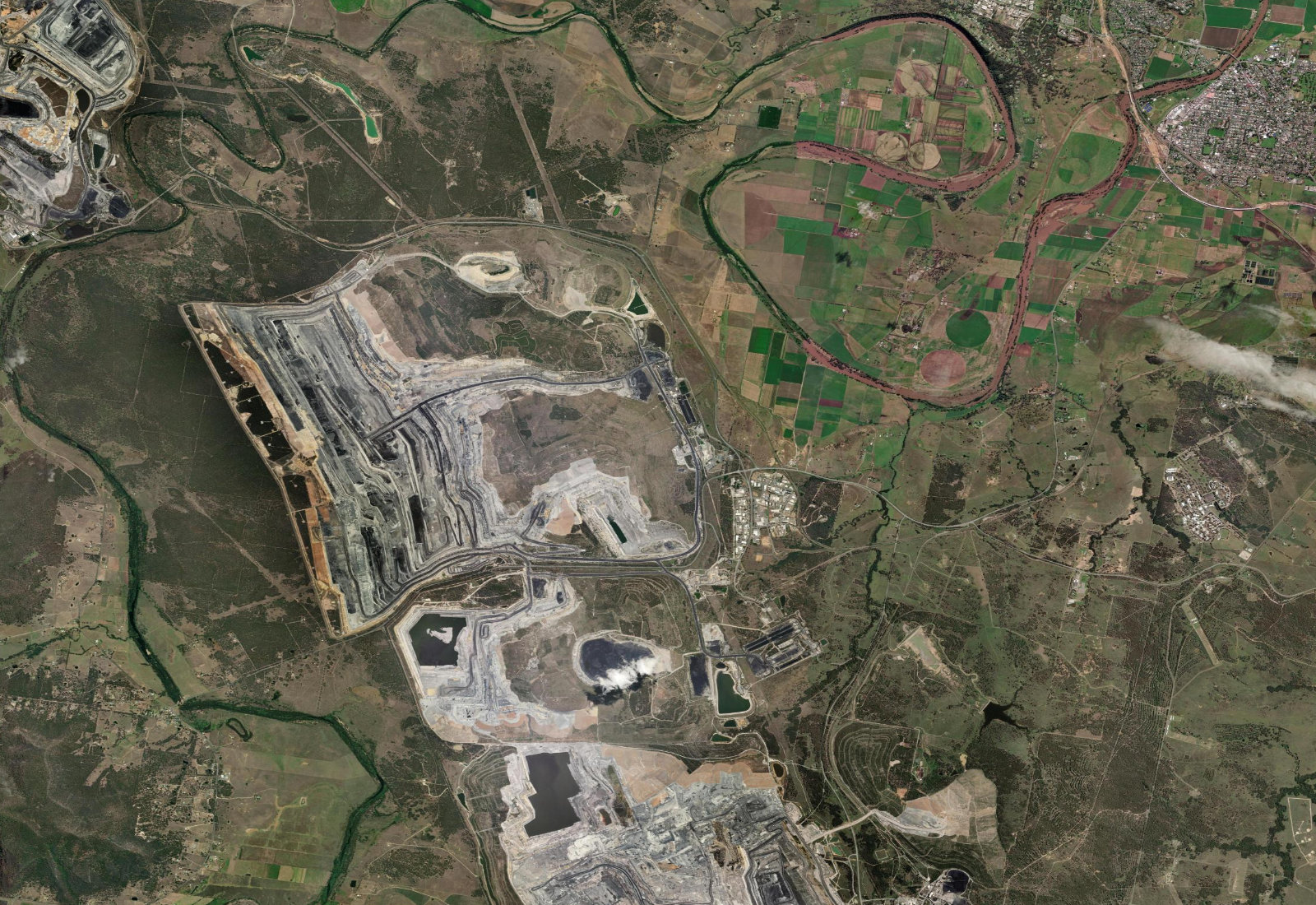
Mount Thorley Warkworth · Hunter Valley
The mine the papers photograph as a scar.
The Guardian, 20 July 2016, “Full of holes: why Australia’s mining boom will leave permanent scars”: “Many of the huge open-cut coalmines that scar the landscape have been in operation only since the 1970s or 80s.” Mount Thorley Warkworth is that kind of mine. Its expansion was the fight over the village of Bulga. On 6 March 2015 the Guardian ran an aerial of the pit beside the proposal to move the village.
From above, the terraces are the dominant object in the district. Putty Road runs along the southern side. That is the next frame.
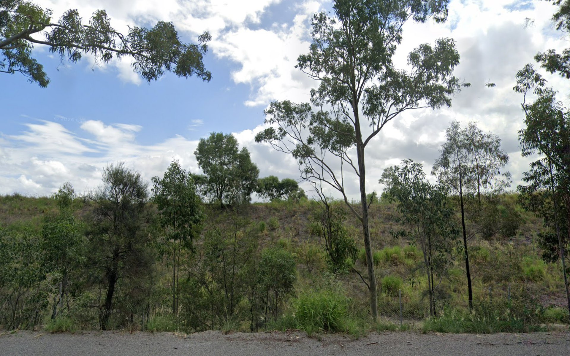
Putty Road, Bulga · looking at the bank
The road sees the bund that was built to hide the pit.
February 2026, looking north. Yancoal’s 2024 annual review for Mount Thorley Warkworth says a visual bund was built that year along Putty Road beside the Warkworth West Pit, with shade-cloth on the boundary fence and trees planted as a screen.
This is that bank. Grass, young eucalypts, a fence. OpenStreetMap’s mine polygon comes to about 30 metres from the camera, because the mapped area includes the bund and the land up to the road. That 30 metres is the distance to the boundary, and the terraces in the aerial sit behind the bank. A hole can be hidden by the spoil that came out of it.
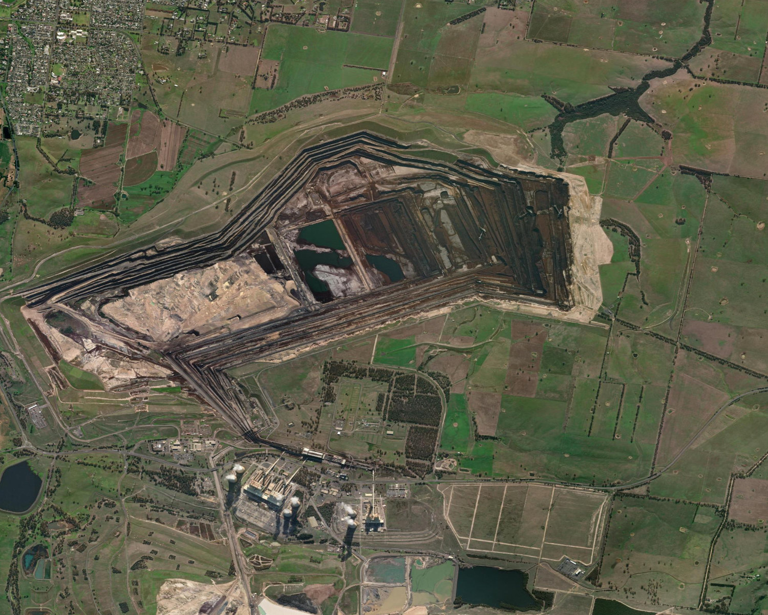
Loy Yang, Victoria · from above
And again. A pit the size of a suburb, from the air.
South of Traralgon. Loy Yang is one of the three Latrobe Valley brown-coal pits, with Yallourn and Hazelwood. David Langmore, in Landscape Australia on 9 January 2017, put the three together at over 50 square kilometres, and the Loy Yang void at about 200 metres deep. “The scale of the open-cuts of the Latrobe Valley are not huge, they are gargantuan.” The outline mapped on OpenStreetMap is about 1,160 hectares.
He also wrote that few people outside the valley have any sense of that scale. Apart from limited glimpses of Yallourn and Hazelwood from the Princes Freeway or the Gippsland line, most people are never somewhere they can see even one of the pits. The terraces in this picture are a view from above. The power station sits on the southern edge.
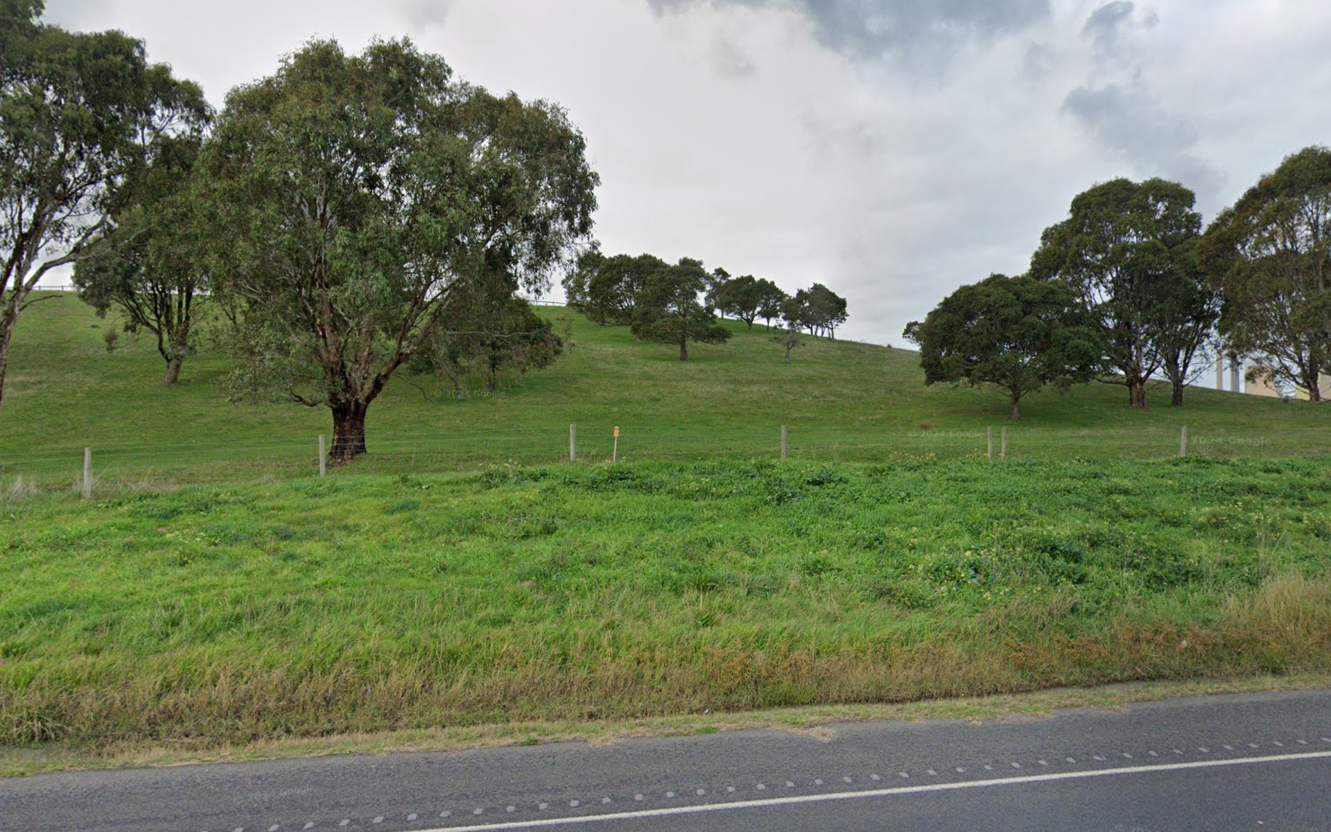
Traralgon Creek Road · about 380 m to the mapped edge
And again. The road sees the grassed slope.
June 2024, near Jack Vines Lookout, the public platform built so that people can see into Loy Yang. This frame is the road, not the platform. The camera looks east, toward the pit. The mapped boundary of the mine is about 380 metres away. Along the same heading, the satellite stays grass until about 400 metres, where the worked ground begins. The terraces are on the far side of this slope.
A hole 200 metres deep can sit behind a hill that was made of what came out of it. The lookout is there because the road does not show you the void.
Macarthur, Victoria · 185 m to the nearest tower
At the same distance, the turbine fills the sky.
Macarthur wind farm: 140 Vestas V112 turbines, hub 85 metres, rotor 112 metres, about 140 metres to the blade tip. Commissioned in 2013. 420 megawatts. These are the shorter machines. The 270 metre figure is a newer class, and it is not in this picture.
June 2024, Macarthur–Hawkesdale Road. The nearest tower is 185 metres away, almost dead ahead. The camera is tilted up 10° so the blade stays in frame. At that distance a 140 metre tower subtends about 37°. The next tower in the frame is about 660 metres away.
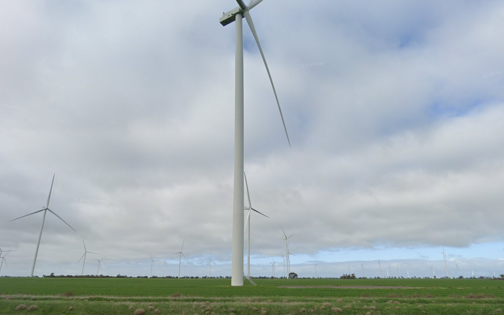
Barrat Road, Murra Warra · 143 m to the nearest tower
And again. These are taller, and the country is flat.
Murra Warra, north of Horsham, has been operating since 2019. Stage 1 is 61 Senvion turbines, hub 139 metres, rotor 144 metres, about 211 metres to the blade tip. Stage 2 is 38 GE Cypress turbines, hub 141 metres, rotor 158 metres, about 220 metres to the tip. That is the higher class already standing. Macarthur’s hub is 85 metres.
September 2025. The nearest tower is 143 metres away, almost dead ahead. The next one on the same line is about 680 metres. There is no ridge helping them. The camera is tilted up 18° so the nacelle stays in frame. One blade still leaves the top. A 210 metre tip at 143 metres is about 56° tall.
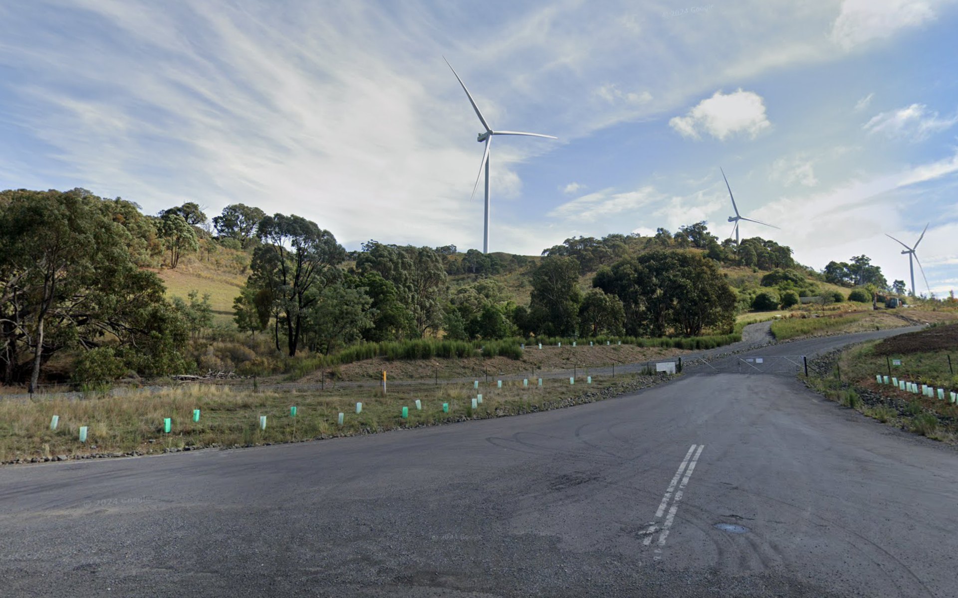
Grassy Creek Road · 570 m to the nearest tower
And again, in New South Wales. At 570 metres, they are still the skyline.
Rye Park, north of Yass: 66 Vestas V162 turbines, hub 119 metres, rotor 162 metres, 200 metres to the blade tip. Fully operating from late 2024. This frame is April 2024, while the farm was being commissioned. The machines in the picture are up.
The camera is on the public road. The gate and the gravel track are the farm entrance beside it. The nearest mapped turbine is 570 metres away, near the middle of the frame. The next is about a kilometre. A 200 metre tower at 570 metres is about 19° tall, roughly 36 times the width of the sun. The camera is tilted up 6°.
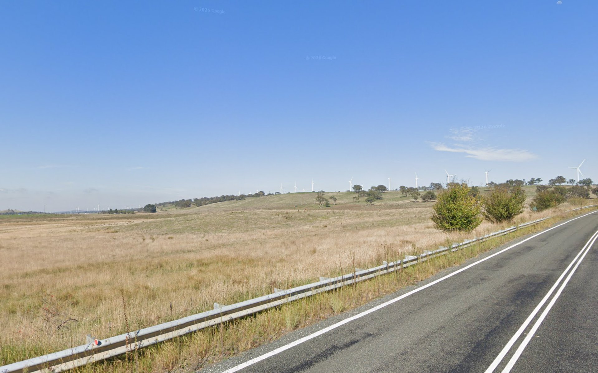
Cullerin Road · nearest tower 2.0 km
A few kilometres out, on a ridge, they are still obvious.
Cullerin Range wind farm, commissioned 2009: 15 turbines, 30 megawatts, hub height 80 metres. Eight have 82 metre rotors and seven have 92 metre rotors, so the blade tip is about 121 or 126 metres.
April 2026, looking southwest. The nearest turbine in this frame is 2.0 km away, at the right-hand edge. The white row on the ridge runs from there to a little past 3 km. The published middle of the farm is 3.6 km from the camera. More machines further down the same range, including Gunning, sit beyond the main row. A 126 metre tower at 2 km is about 3.6° tall, around seven times the width of the sun.
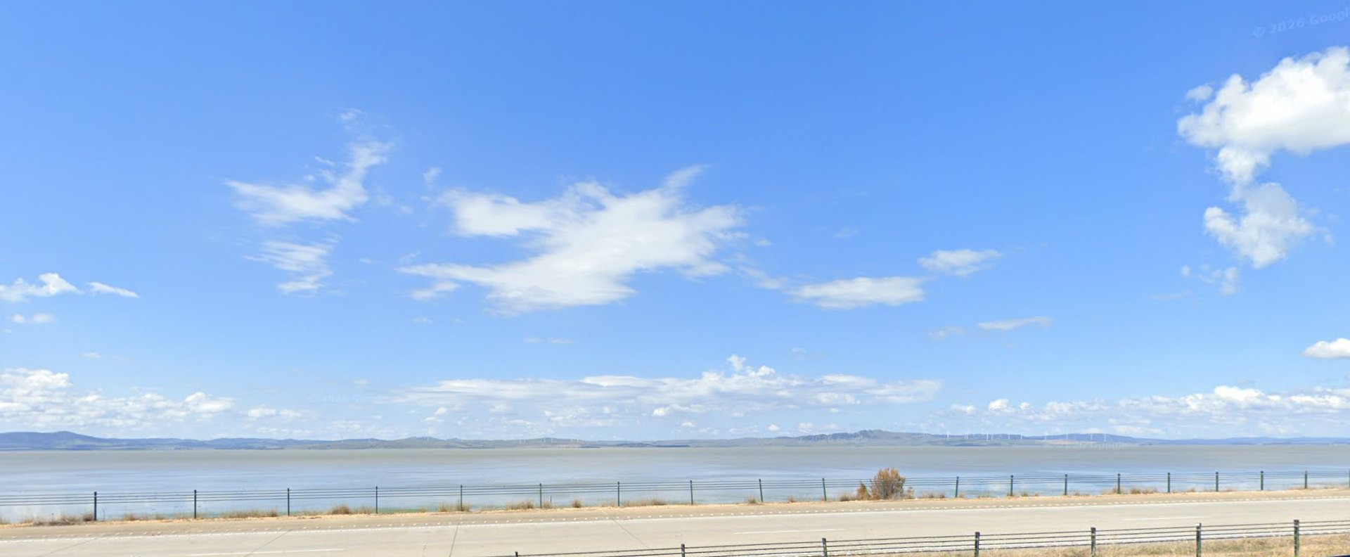
Federal Highway · nearest towers 9.2 km
Across the lake, they are still a row on the skyline.
April 2026, looking east-south-east. The ticks on the escarpment are turbines. The nearest mapped machines here are 9.2 km away. Capital Wind Farm’s published centre is 18.8 km, almost on this heading: 67 Suzlon S88s, about 124 metres to the blade tip. Woodlawn shares the ridge. The next slide enlarges the right-hand part. A passing car has been cropped off the bottom. The horizon is unchanged.

Same photograph · right-hand portion · enlarged three times
The row, big enough to check.
This is a crop of the frame you just saw, not a tighter camera. The field of view is still 75°. The turbines look larger here because the crop is displayed bigger. On the ridge they read as towers. At the farm’s centre, 18.8 km, a 124 metre machine is 0.4° tall, smaller than the sun, and the row is what makes the further ones readable.
Why the two views diverge
A hole has no height above the horizon. A tower does.
Stand outside the rim and the void is behind the batter, the spoil, and whatever has been planted on them. That is why the aerial and the road photograph of the same mine look like different places. The Putty Road bank is the spoil, shaped so the road does not see the pit.
A tower’s angular height is the arctangent of its height divided by its distance. The sun is about half a degree across.
| Tower | Distance | Angular height | Against the sun |
|---|---|---|---|
| 140 m | 185 m | 37° | Fills the frame |
| 210 m | 143 m | 56° | Fills the frame |
| 200 m | 570 m | 19° | About 36 suns |
| 126 m | 2.0 km | 3.6° | About seven suns |
| 126 m | 3.5 km | 2.1° | About four suns |
| 124 m | 9.2 km | 0.8° | About one and a half suns |
| 124 m | 18.8 km | 0.4° | Smaller than the sun |
| 270 m | 20 km | 0.8° | Same angle as the 124 m tower at 9.2 km |
The last line is a scaling, not a photograph. These frames include taller machines: Murra Warra at about 210 to 220 metres, and Rye Park at 200. A 270 metre turbine at 20 kilometres was not photographed.